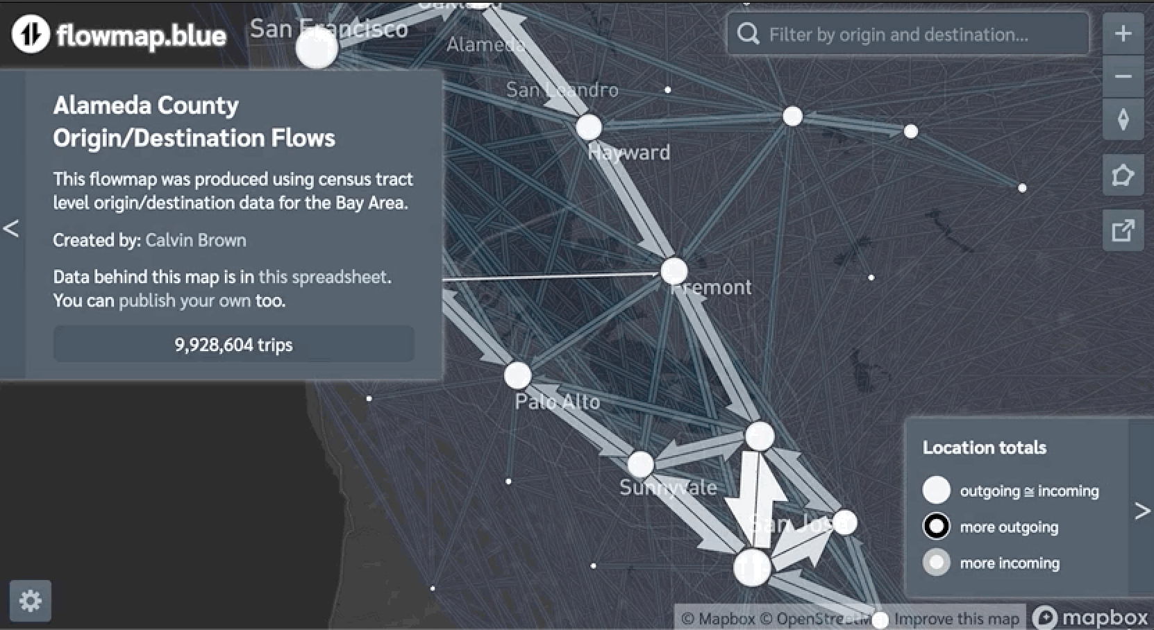
Visualizing Travel Behavior Data Using Python and Flowmap Blue
I developed a script that processes origin/destination data and uses Flowmap Blue to visualize the origin/destination travel flows of over nine million average weekday trips within Alameda County.
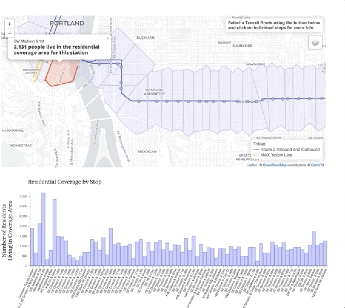
TriMet Residential Coverage Analysis
I developed a Python driven Residential coverage analysis of Trimet's bus route 2 and Max Yellow Line. The results of the analysis are displayed in an interactive data dashboard.
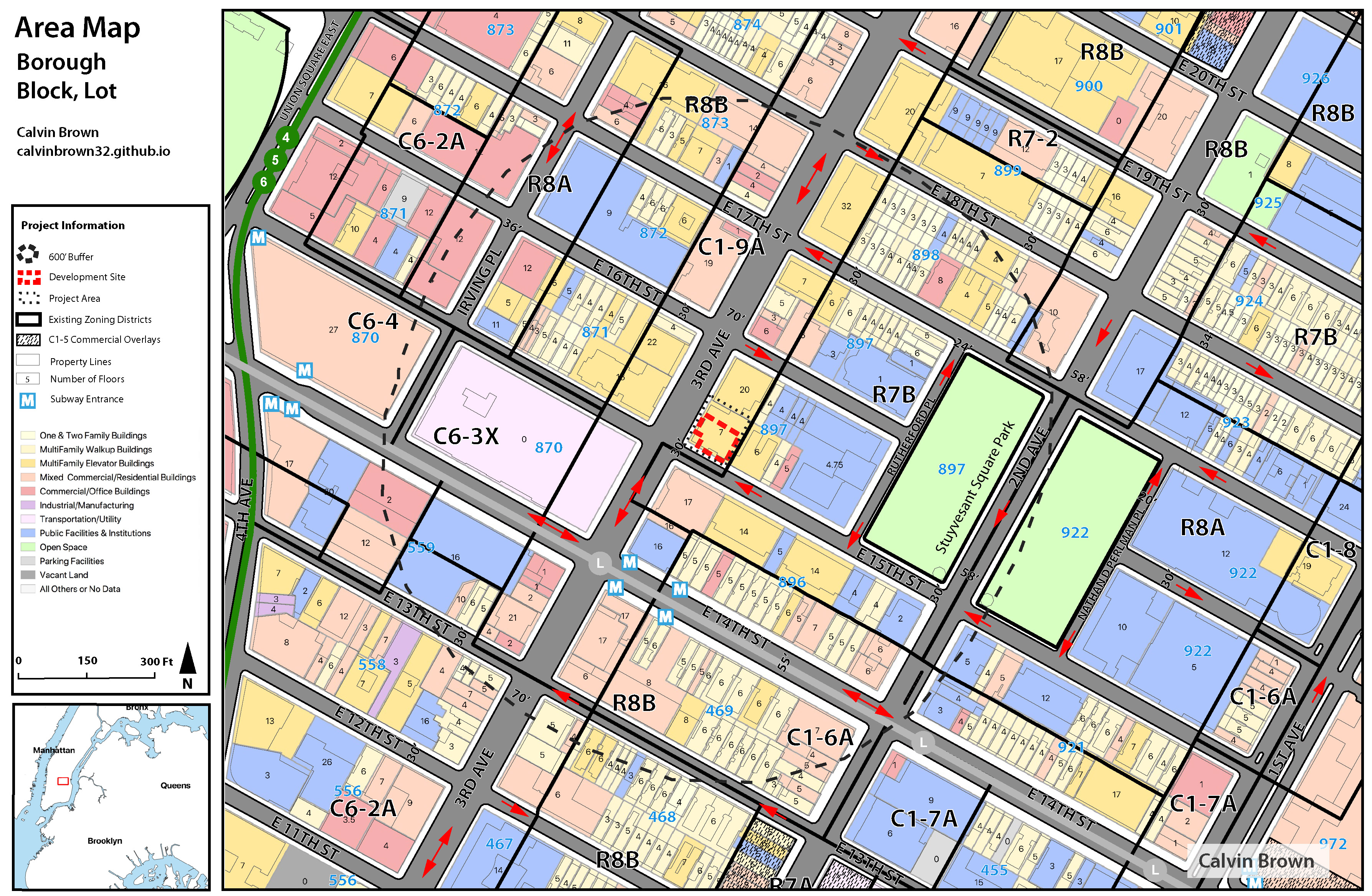
Custom Maps for Last Subway
I designed 10 custom maps for Philip Plotch's Last Subway: The Long Wait for the Next Train in New York City, published and available at Cornell University Press.
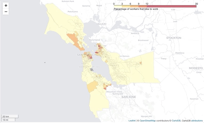
Automating Data and GIS Analysis Using Python
I created a tool that automates the downloading, processing, and visual communication of census mode share data.
Arrow Highway Multimodal Regional Corridor Plan
Pedestrian and bicycle improvements along or near Arrow Highway to improve east-west connectivity and safety within Glendora, San Dimas, La Verne, Pomona, and Claremont, CA
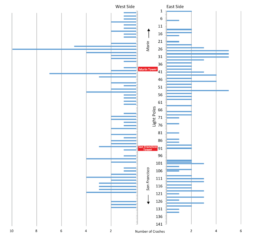
Golden Gate Bridge Bicycle Safety Study
I conducted a bicycle safety study for the Golden Gate Bridge, Highway and Transportation District.
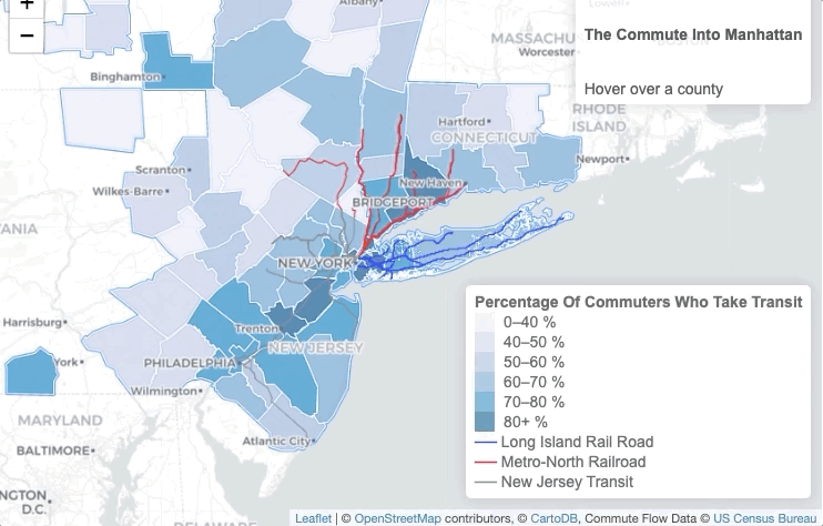
The Commute Into Manhattan
Interactive web map and graph that show that the majority of people who commute into Manhattan do so on transit.