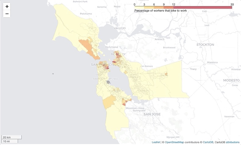
I created a Jupyter Binder (see link below) that uses Python to automate the downloading, processing, and visual communication of census data. The Notebook walks users through the process of downloading census data via the Census Data API, munging the data to calculate bicycle mode share by census tract, and joining the data to census tract geographic data for mapping. Finally, the script uses Folium and Leaflet to create an interactive choropleth map that displays the bicycle commute to work mode share for each census tract.
Project Goals
- Automate the downloading, processing, and visual communication of census data.
- Introduce colleagues to the power of using Python to develop well-documented, reproducible analyses and automation tools.
- Test Jupyter Binder as a cloud computing solution for sharing Python based automation and analysis tools worldwide.
- Create easy-to-use, interactive and standalone Python tools that don't necessitate additional software or the configuration of a complex python environment.
- Foster cross-discipline collaboration by making the Python development process more transparent and accessible.
Hover over the map to see a quick demo of the final output:
Click here to load the Binder:
 It may take a few minutes to load!