Urban Planner, Data Analyst, Cartographer, Transit and Safe Streets Advocate
AutoCAD and SketchUp Projects
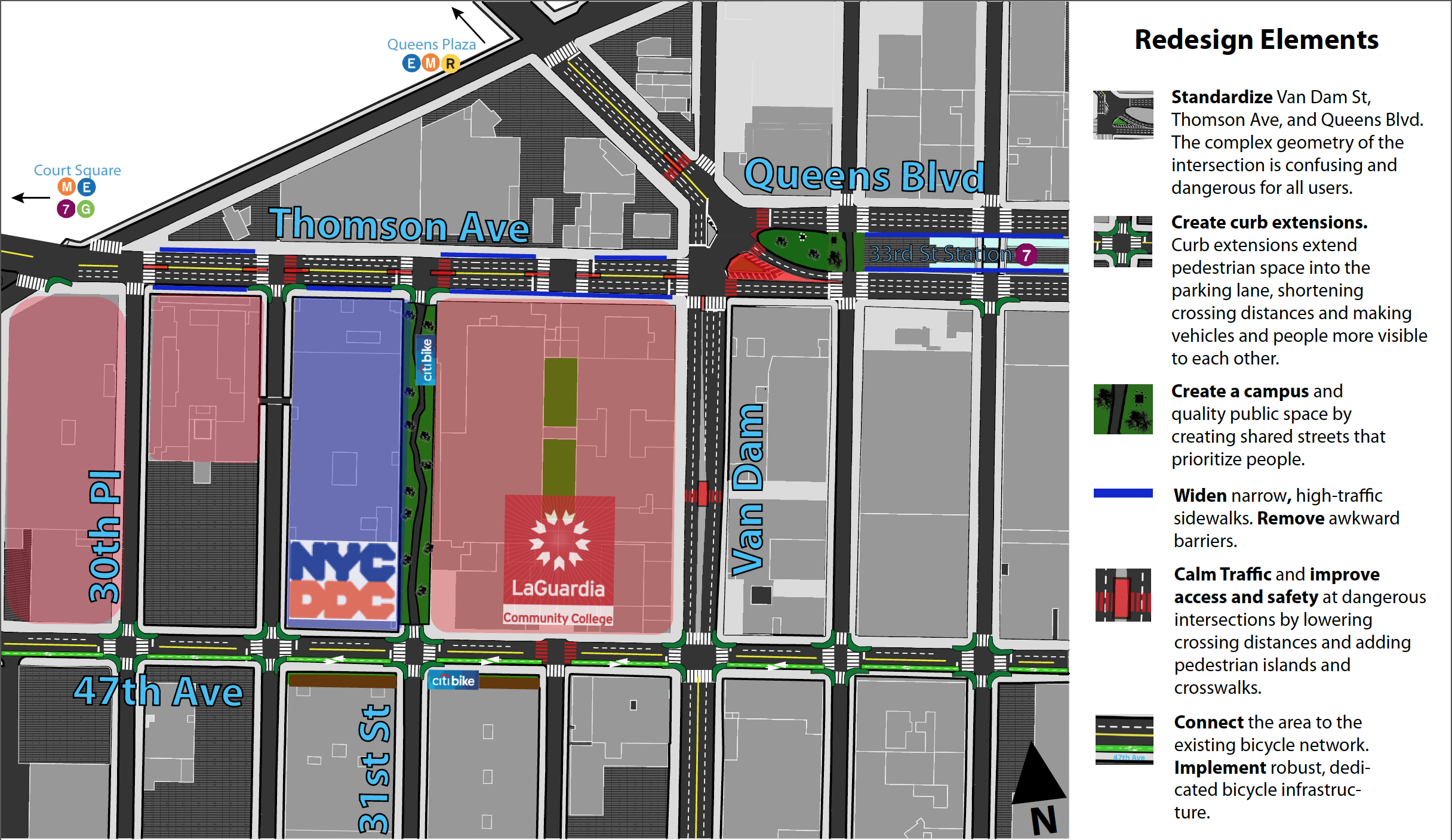
I created these graphics as part of a studio project at Hunter College Urban Policy Planning. The studio team re-envisioned the area surrounding LaGuardia Community College to mitigate traffic safety and quality of life issues facing LaGuardia Community College Students and nearby office workers.
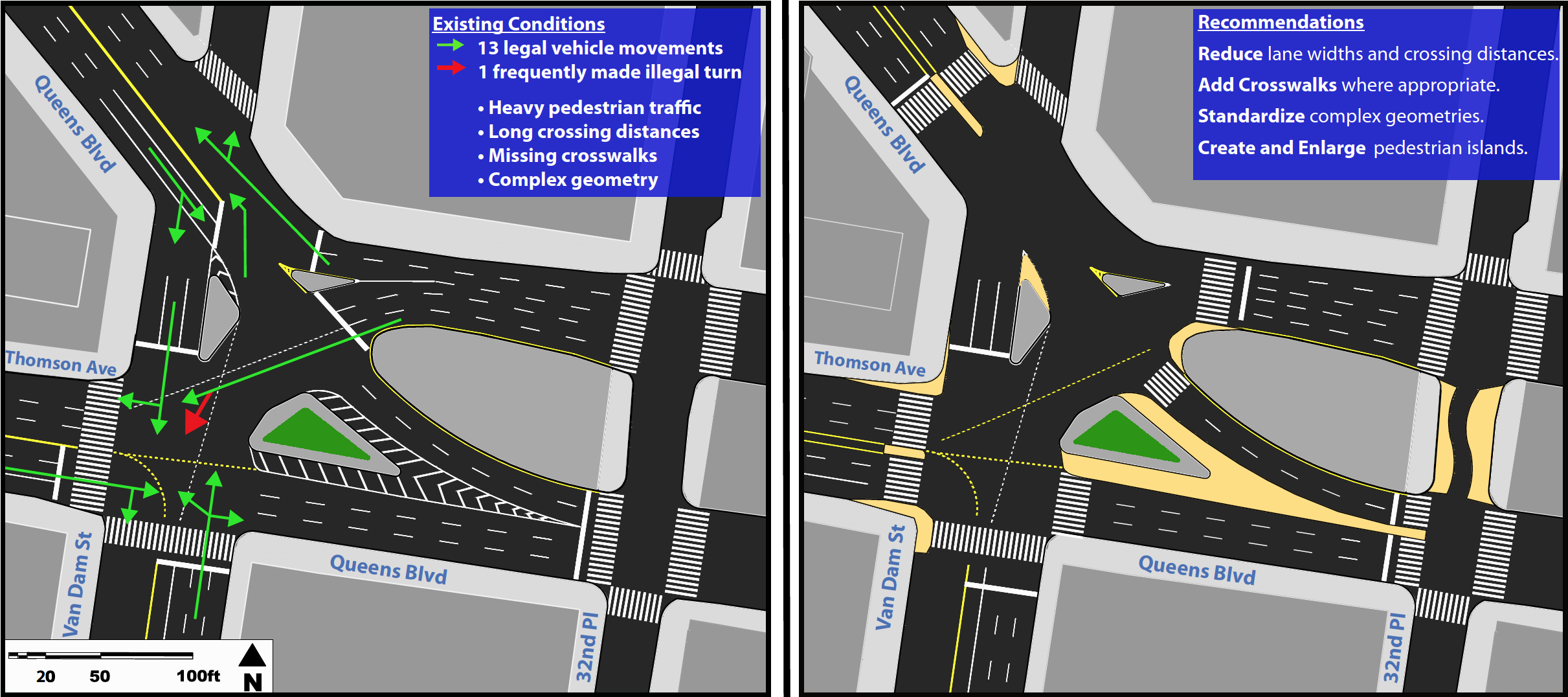
Envisioning Calmer Intersections
I envisioned small, pragmatic adjustments and calming measures to mitigate the severe safety at the intersection of Queens Boulevard, Van Dam Street, and Thomson Avenue.
Safer Streets for East Long Island City I developed a set of recommendations that address the traffic and pedestrian safety issues in the area surrounding LaGuardia Community College.
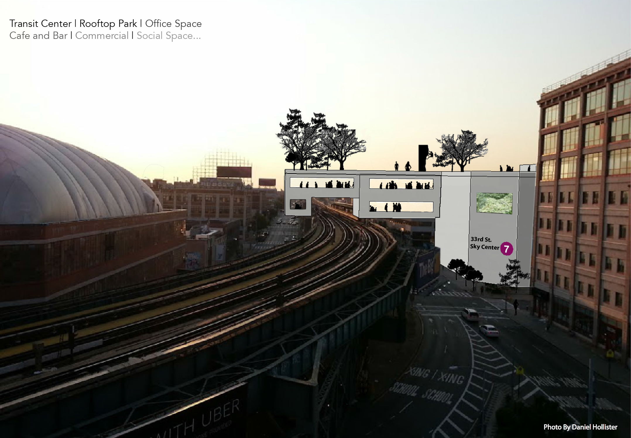
33rd Street Sky Center I envisioned a public-private transit-oriented development that mitigates a number of transportation and quality of life issues at 33rd St. - Rawson St. 7 line stop.